Introduction
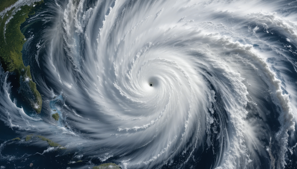
Hurricane Erin has emerged as one of the most dramatic storms of the 2025 Atlantic hurricane season. What began as a modest tropical wave quickly escalated into a Category 5 powerhouse, affecting communities from Cape Verde to the Caribbean and prompting widespread coastal alerts across the Atlantic seaboard.

Formation and Early Impacts in Cape Verde:
Erin’s journey began over the Cape Verde Islands on August 11, originating from a tropical wave that unleashed torrential rains on São Vicente. Heavy rainfall triggered destructive flash floods, in just five hours In just five hours, claiming at least nine lives, displacing 1,500 people, and prompting a state of emergency declaration for São Vicente and Santo Wikipedia+1. Th. The World Bank pledged US$10 million in recovery assistance to help the affected communities rebuild.
Rapid Intensification: From Tropical Storm to Cat 5 in a Day
Once Erin crossed into the Atlantic, conditions became ripe for explosive intensification. The storm attained hurricane status by August 15, and pressure readings and wind speeds surged dramatically the following day. By the afternoon of August 16, Erin had reached its peak as a Category 5 hurricane, with sustained winds of 160 mph (255 kph) and a central pressure estimated around 915 mb, making it the earliest Cat 5 storm recorded in the open Atlantic.
Meteorologists noted Erin’s remarkable intensification—its wind speed more than doubled in just 24 hours, ranking among the fastest on record. One observer tweeted that its 55-kt uptick in intensity over 12 hours was exceeded by only three other Atlantic hurricanes in the past 50 years .

Fluctuation and Expansion: Category Evolutions
Following its peak, Erin underwent an eyewall replacement cycle, reducing its intensity to Category 3 (around 125 mph) by early August 17. However, the storm soon reintensified to Category 4 by August 18, while its wind field significantly expanded.
Regional Effects: Caribbean and Island Nations
Although Erin didn’t make direct landfall, its eyewall and outer bands caused notable disruptions:
- In Puerto Rico and the U.S. Virgin Islands, strong winds and torrential rains knocked out power to over 147,000 customers and cancelled more than 20 flights. By Monday morning, around 96% of those affected had their power restored.
- Some islands including the Turks and Caicos Islands and parts of the Bahamas experienced tropical storm conditions. Authorities issued tropical storm watches and, in some cases, declared readiness for evacuation. Public services were suspended, and vessels were ordered to stay ashore.
Coastal U.S. and Maritime Impacts: A Wide-Reaching Threat
Despite remaining offshore, Erin’s impressive size and strength generated dangerous ocean conditions along a vast swath of the Atlantic coastline:
- Coastal regions from Florida to New England, including the Outer Banks of North Carolina, Bermuda, and parts of Atlantic Canada, are bracing for life-threatening surf, rip currents, and coastal erosion.
- In North Carolina, Dare County declared a state of emergency. Mandatory evacuations are underway for Hatteras Island and Ocracoke Island due to risks of flooding, road washouts, and high surf.
- Warnings about 20-foot waves and extreme rip currents have been issued, especially on Bermuda, where rogue waves up to 30 feet are possible.
- The U.S. East Coast, including the Jersey Shore and New York City beaches, are likely to experience 8–12 foot waves, dangerous rip tides, beach erosion, and gusty winds that crest at 20–40 mph.
Scientific and Seasonal Significance
Erin is the first hurricane and first major hurricane (Category 3+) of the 2025 season, and also the fifth named storm overall.
Its extraordinary rapid intensification serves as a textbook example to scientists studying climate-linked hurricane behavior. The eye-wall replacement cycle observed offers insight into storm dynamics and future predictive models
Conclusion
Hurricane Erin’s transformation—from a tropical wave to a Category 5 storm in scarcely a day—has rendered it one of the most compelling and sobering storms of 2025. While it spared major landfall, its far-reaching impact across the Atlantic, from flash floods in Cape Verde to hazardous conditions along East Coast beaches, highlights its formidable power.
Erin serves as both a reminder of natural fury and a call to communities and authorities: preparedness isn’t optional—it’s imperative.

